
24 Mar Central Kootenay Web Map
Need more information about Kootenay Lake?
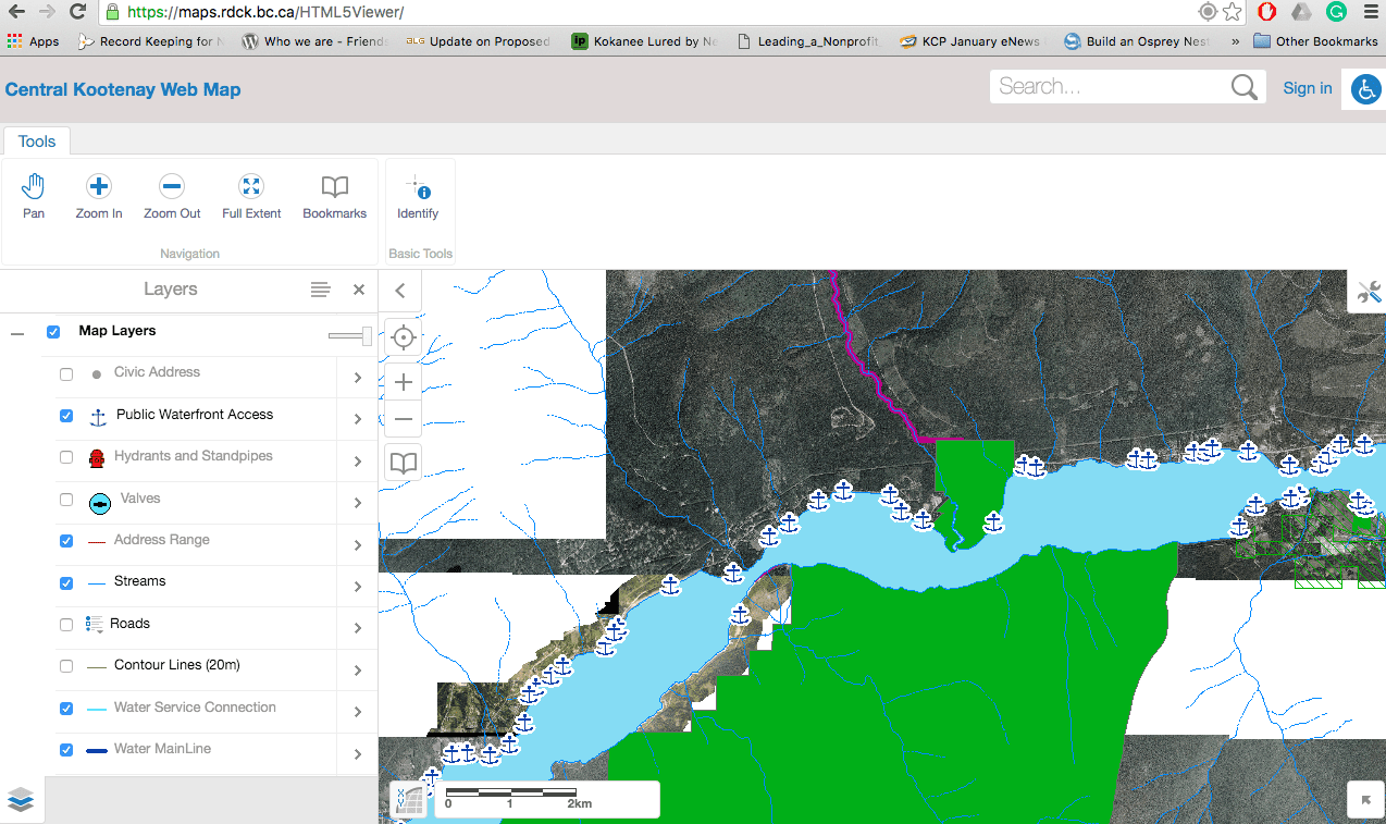
Here is an incredible map tool to access much of this information, from simple geographical layout to specific questions in regards to where my property lines lie.
Use the “layer” tab on the left-hand side of the screen to choose the area that you are looking to learn about. This tab shows the public access on Kootenay Lake’s West Arm.
The Central Kootenay Web Map is a free mapping site provided by Geospatial Services at the Regional District of Central Kootenay.
The RDCK’s goal is to ensure access to spatial and related non-spatial information to the Regional District, our Municipal Partners, Referral Agencies, and the Public.
This information includes but is not limited to:
- Legal Boundaries
- Service Areas
- Land Use Regulations
- Utility Information
- Aerial Imagery
Access the map through the RDCK Website or just click here and begin your adventure with it.